Navigation Menu

Disko Bay Ice Coring Project

A research expedition blog by Milton Academy science faculty member, Matt Bingham

The Easter Bunny

Posted by on Apr 20, 2014

easter

The Easter Bunny found us in Ilulissat!  We were all sleep deprived but most of us were awoken by the first Easter service of the morning at the church down the street.  Sometime between 7-8 am they rang the church bell to signal either the start or the end of the service.  That sets off the sled dogs in town.  So there was an interesting wake up call of church bells with a background chorus of dog howling!

Happy Easter and good luck to all the runners tomorrow!  Hope you have a nice day.

Read More

Planes, Helicopters, Dogs, and Icebergs

Posted by on Apr 20, 2014

It’s snowing again.  If this was a ski town, tomorrow would be a sweet powder day.  Greenland in April!  It is most definitely still winter here though there are plenty of signs of Arctic spring.  The open ocean is free of sea ice (mostly) and the days are very long.  Even at midnight last night I could still see light in the sky behind the mountain ridge out my window.  Why was I up at midnight you might ask?


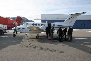
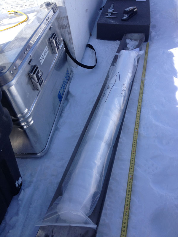
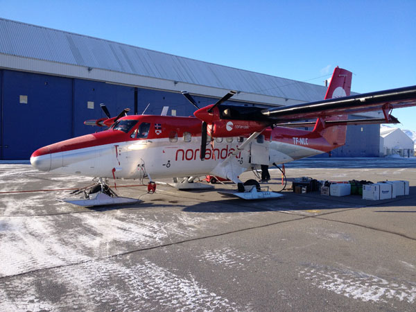
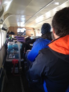
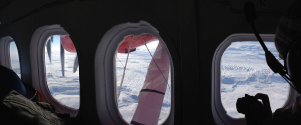
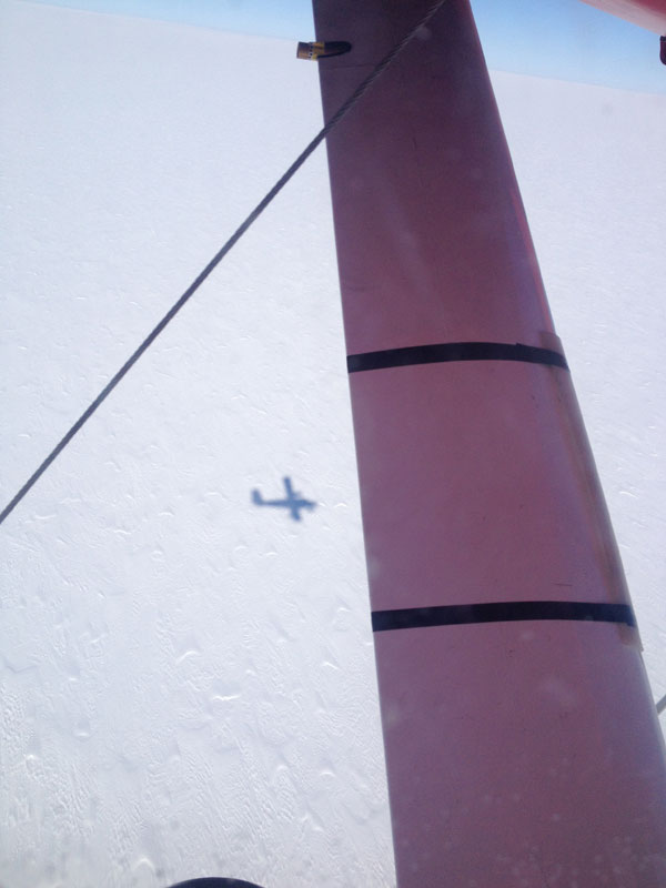
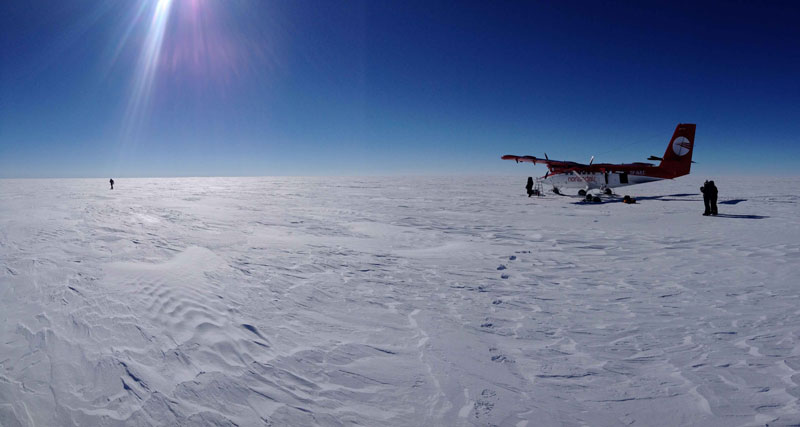
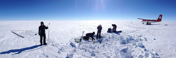
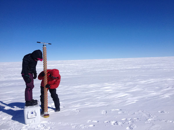
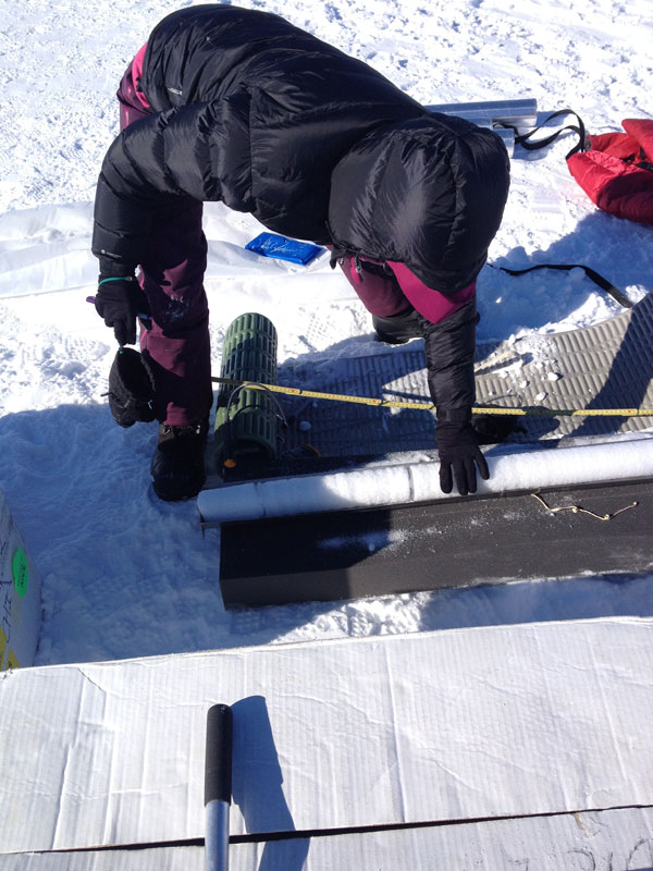
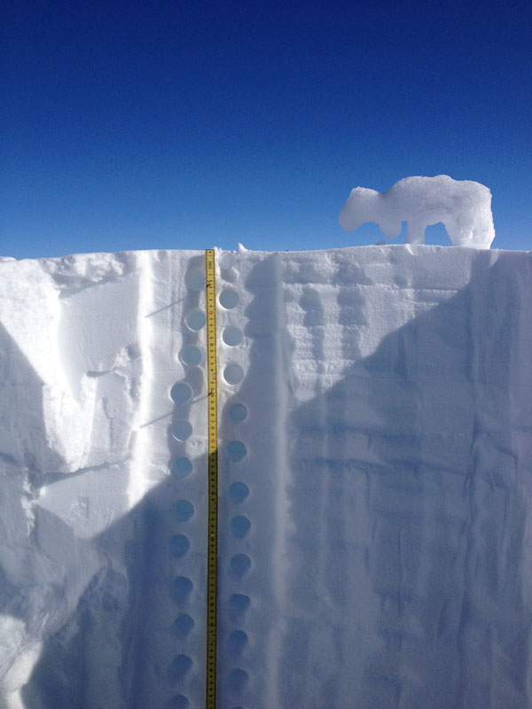
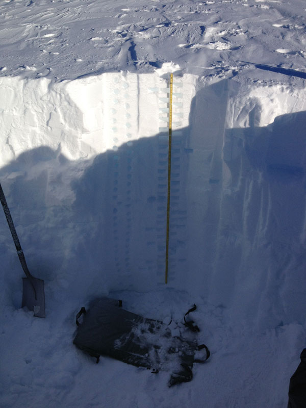
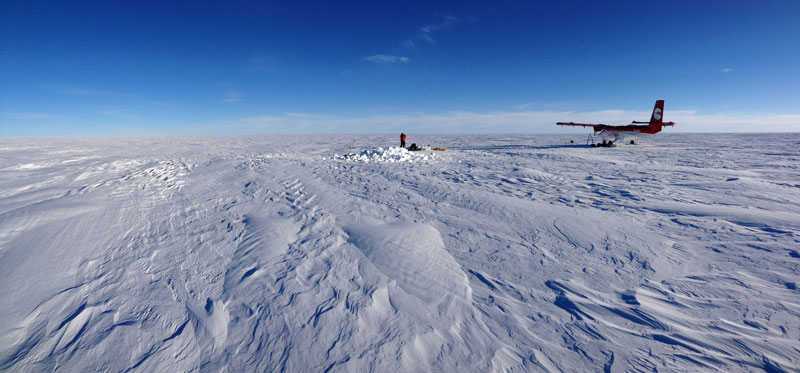
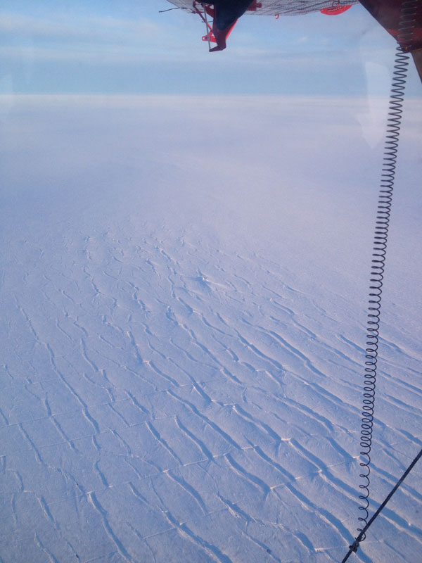
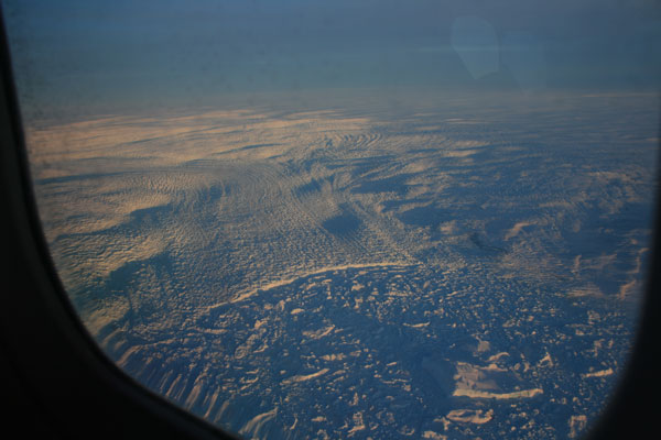
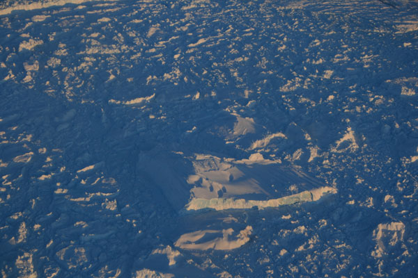
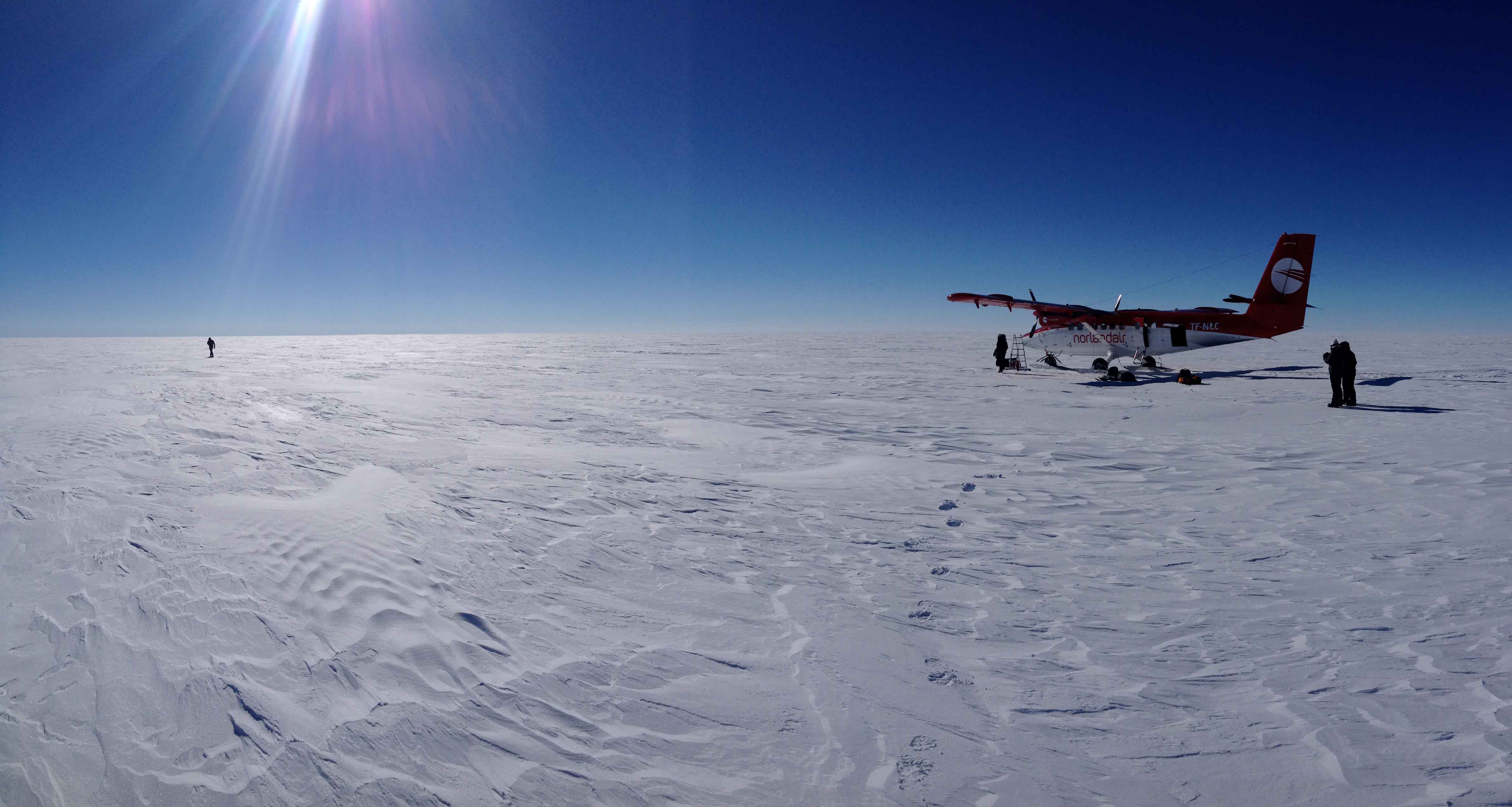
Well the last few days have been exciting and busy.  If you have been reading, you know that Thursday it was also snowing and we were pinned down in Ilulissat.  Friday we had planned to head up to our second ice sheet site around 1-2 pm, but the weather was clearing faster and the pilots told us to pack up ASAP, so we scrambled a little faster than we anticipated and got over to the airport.  As you can see in my Instagram photos (click the camera icon to the right), going to the airport is a little different.  We just drove right up to the plane and loaded our gear.  We had about an hour flight up to site number 2 and the further inland we flew, the better the weather got.  With the recent weather there was a little more moisture in the air and we could see our plane shadow on the ice sheet with a long straight shadow line stretched out behind-our contrail.Like last time, we landed on the ice and got to work.  Friday’s work was just like the last field day, but much warmer, minus 25 C instead of minus 32!  Still cold but it felt a lot warmer, at least at first.  Ben and Laura set off to do the geo-physics (GPS measurements and radar surveys), Ashley and I started the snow pit (but when they were done putting the “pajamas” on the Otter engines, the pilots went to town on the pit and dug a full 2m pit), and Sarah and Matt E (and yours truly a little) worked on the core.  By the end of the day we had sampled the whole pit (plus a few extra samples for my students at home), drilled 9 meters of core, and walked 6km of radar transects.

IMG_6179


IMG_6195

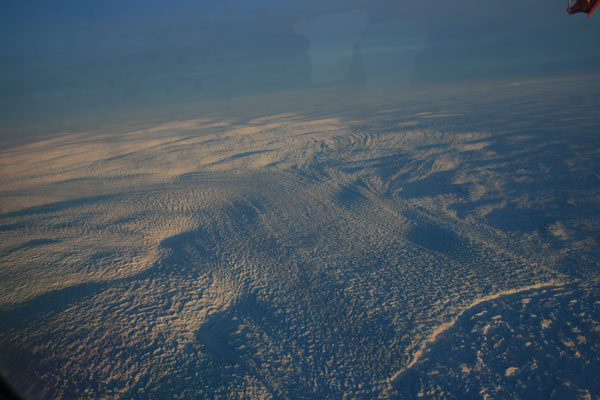
As you can see in the photos the moisture in the air made a very cool sun halo that I had fun playing with with the camera.  We left the ice about 7:30 pm and about 30 minutes into the flight back to Ilulisaat, the pilots told us that we would have to divert to Kangerlussuaq because one of the skis would not retract.  We would have to land on two wheels and one ski, which they assured us was not a big deal, but did require a longer runway.  The Ilulissat runway is quite short-only suitable for small prop planes-while the Kanger runway is long.  So we flew south to Kanger, and, sure enough, the landing was uneventful other than some sparks from the ski on the pavement.  The airport fire crew and the police had turned out though and, when we taxied to the tarmac, they all gathered round to have a look at the ski.

For us, this meant that it was now about 9:30, we had not eaten anything in a while, and all we had was our gear for the field because we were now several hundred miles south and an hour plane flight from our hotel.  Fortunately KISS put us up for the night and Jeff from Polar Field Services met us at the airport and shuttled us and our gear back to KISS for the night.

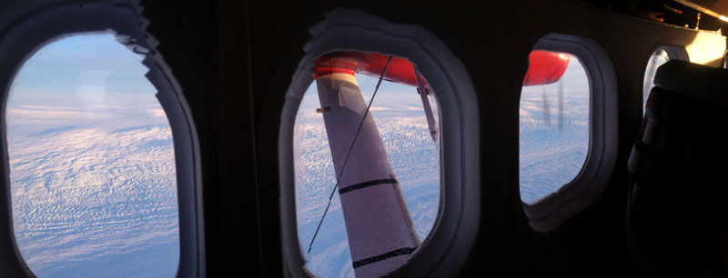
Our Otter pilots, who are from Iceland, were scheduled to be picked up at 8 am to be flown back to Iceland, so they arranged for that plane to shuttle us back up to Ilulissat and then return to Kanger to get our Otter pilots and fly back to Iceland.  So this morning we were up at 6 to pack back up and head to the airport.  We were not sure if all our gear from the Otter would fit in the new aircraft, a Beechcraft KingAir, but it did, and so we flew up to Ilulissat.

IMG_8116

IMG_8161

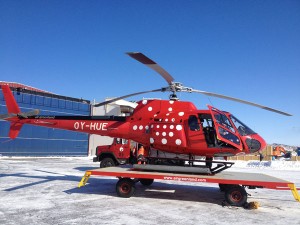
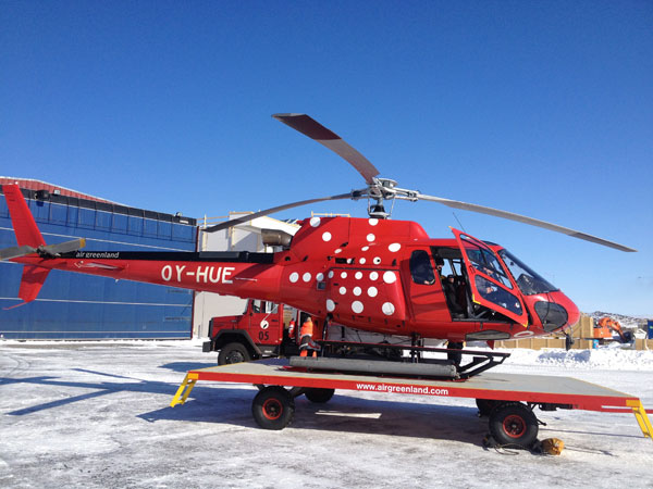
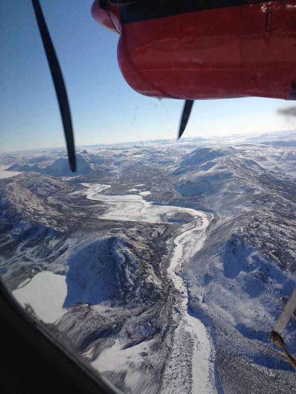
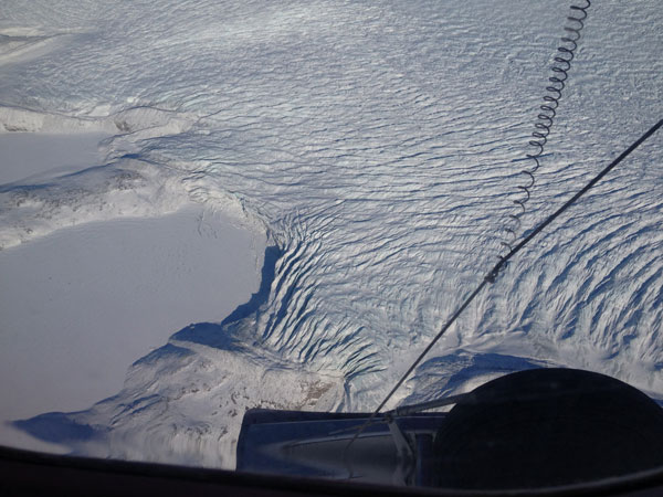
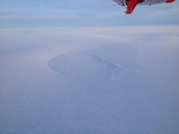
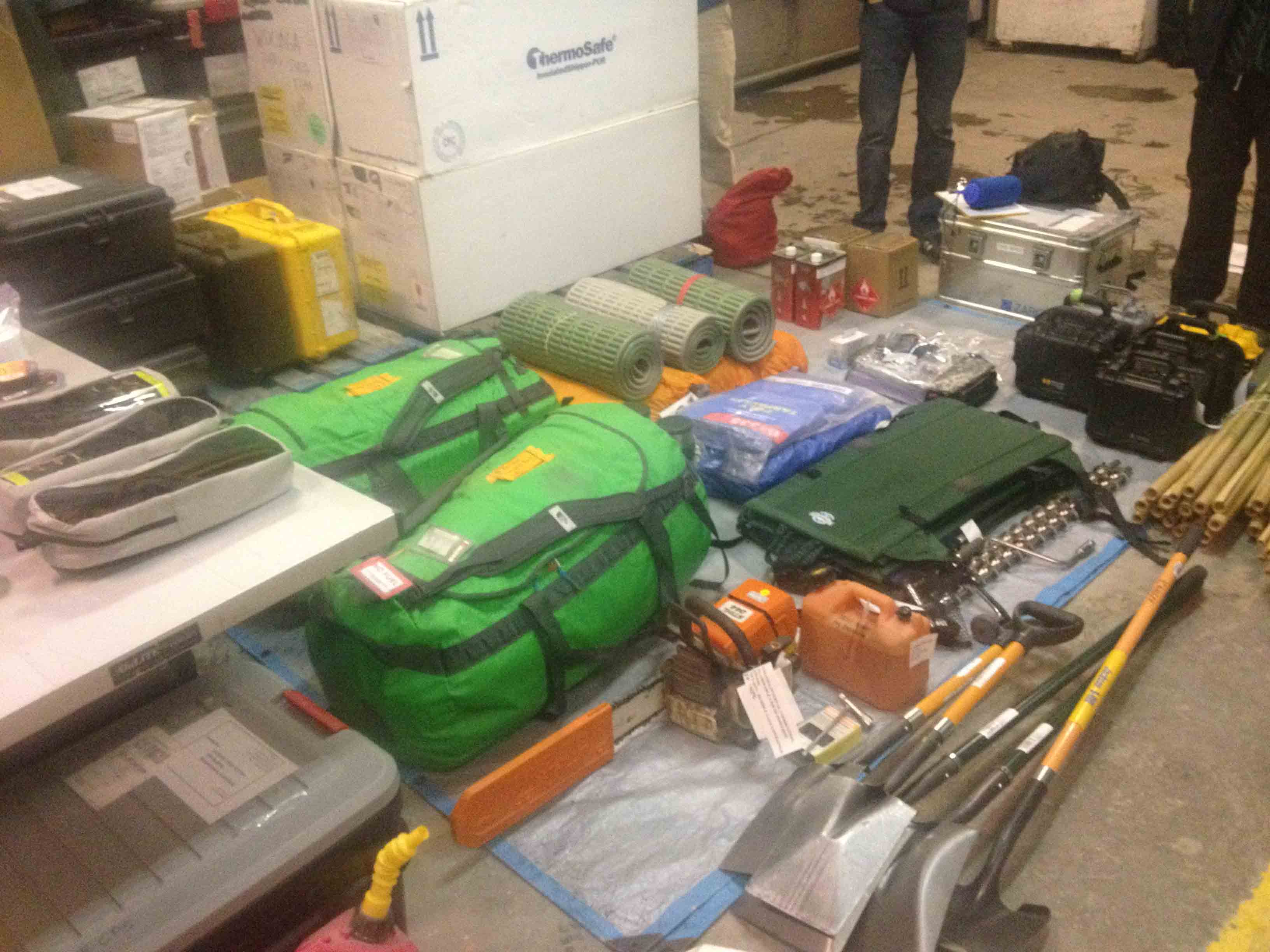
We were scheduled to fly to a field site on Disko Island today and had a helo booked, so as soon as we arrived we had to regroup and arrange equipment for that field site.  Unlike the ice sheet, this site is on a smaller ice cap and the terrain is largely unknown, other than to Ben who has poured over high resolution satellite imagery of the ice.  We are pretty confident that there are no crevasses in the area (based on the satellite imagery) but we need to be careful, so we got all our glacier travel equipment ready (harnesses, ropes, anchors, hardware, etc).  We also needed to organize a fresh set of coring and sampling supplies.  By about noon we were ready to fly and Ben, Laura, and I boarded the A-Star helicopter with our Danish pilot, Peter.  We had determined that we would be the most experienced rope team in case of crevasse danger and, because the chopper can only carry three of us at a time, we would go out first and do a quick box grid of the landing area with the radar to be sure it is crevasse free before the coring team arrived on the second flight.  So off we went, flying out over Disko Bay toward Disko Island.

IMG_6270

IMG_6279

IMG_6293


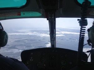
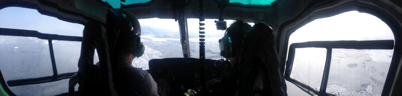
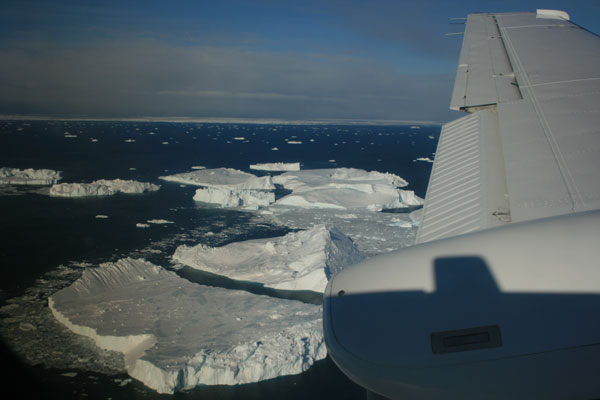
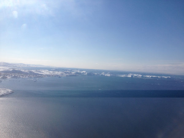
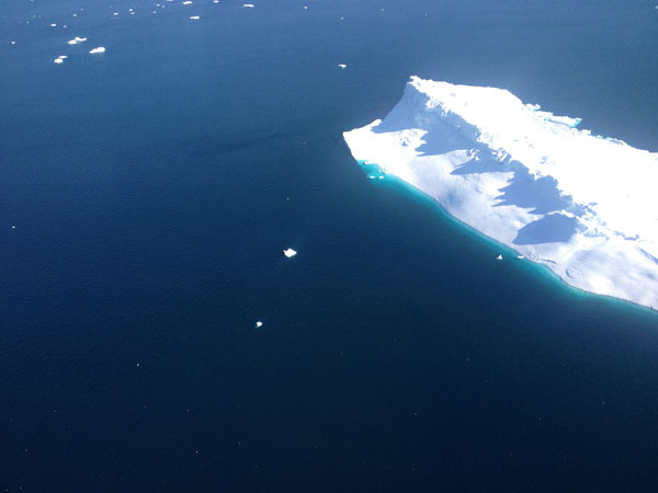
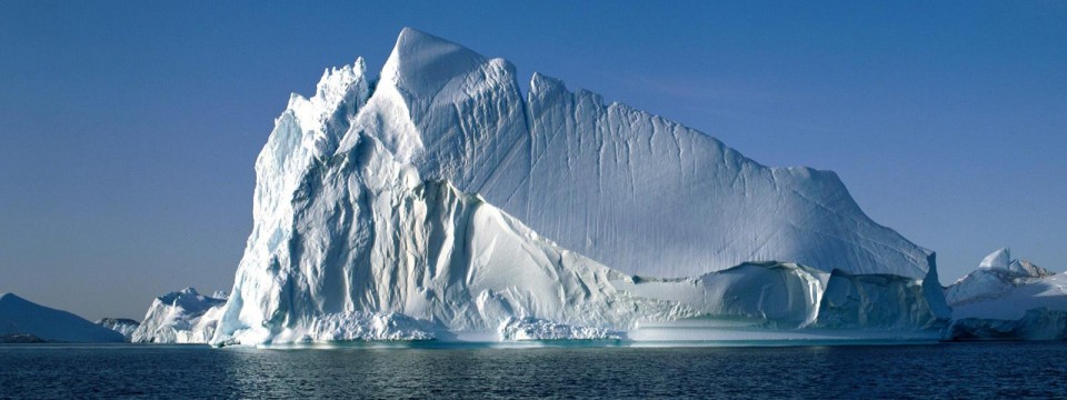
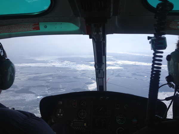
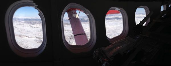
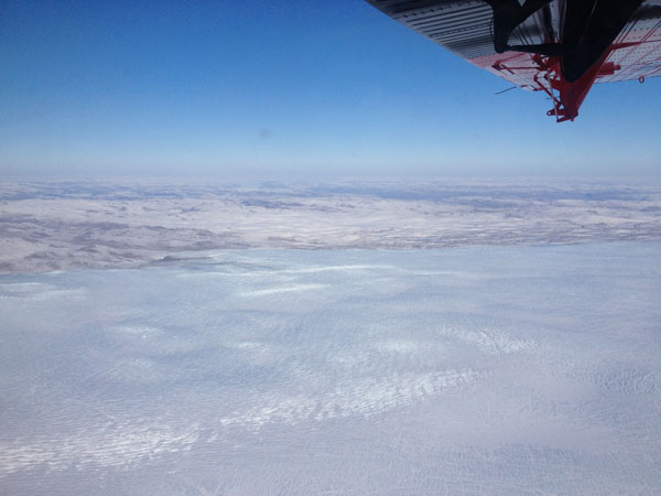
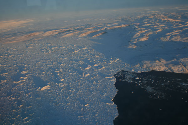
It was a beautiful day . . . but not on the island.  As we got closer and closer, it became clear that the island was mostly shrouded in cloud.  Peter tried to find some holes in the clouds and even took us up to 8000 ft to look over the cloud deck but the ice cap on Disko was socked in and we had to return to Ilulissat.  We did get a nice flight over the ocean with its myriad of different sea ice textures and took a pass past on the massive ice bergs out in the bay on the way back, but we were all bummed to not be out doing our science work.

IMG_6303

IMG_6297

IMG_6299

It is clearly a lot of work to get here and get all the logistics set up so we are eager to do the work we came to do.  At the same time, it has become clear to all of us (Sarah knew this already) that there always has to be a plan B, and C, and occasional D.  As Sarah said today, plan A is always the best one, but you always have to have a backup.

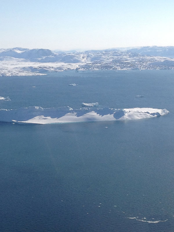
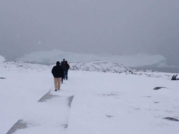
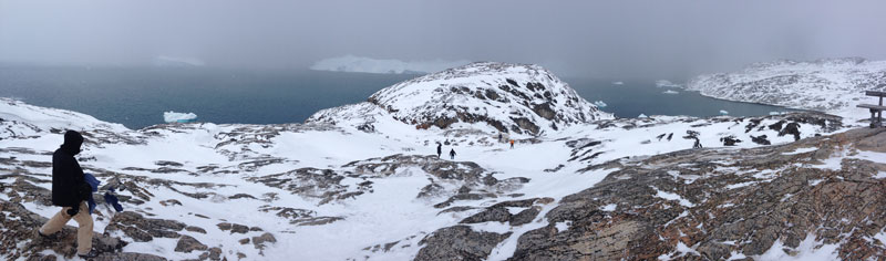
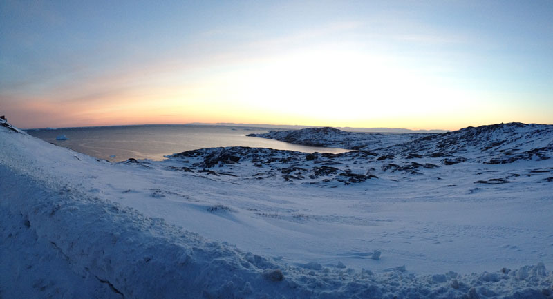
So we were all back in Ilulisaat by about 2:30.  We returned to the hotel and then decided to go for a walk through town and out to the tip of the peninsula that Ilulissat sits on.  From there you can see the huge ice bergs that come out the Jakobshavn fjord.  They get stuck on an old underwater moraine where the fjord meets Disko Bay and there they sit and slowly melt until they are no longer grounded (stuck on the bottom) and can float north on a counterclockwise current around Disko Bay.  When we first arrived, a long flat berg was behind the hospital out on the little point near our hotel.  Two days later it has drifted out in front of us.

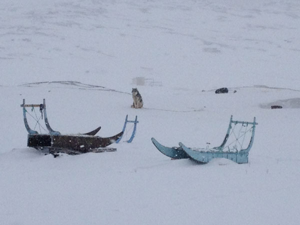
Our hike took us out of town past the many dog teams that call the outskirts of town their home.  Most are used for tourist operations, but at one point in time, dog teams were the primary mode of transportation of the Greenlandic people.  There were probably a hundred dogs out there and at one point many of them started howling like a pack of wolves.

IMG_6320

We hiked out to the point but by the time we got there it was snowing pretty steadily and the nice sunny day from the morning was gone.  The clouds we ran into early in the helo ride had pushed across the bay and descended on us.  We could still see the huge bergs but they loomed in the gray cloud and snow rather than shimmering in the sun like they had earlier in the day.

IMG_6311

IMG_6316

Now that it is after dinner, it has probably snowed 4-5 inches of fluffy powder.  Matt, Sarah, Laura, and Ben are playing cards.  Tomorrow the Easter Bunny comes so we have a down day for the holiday.  We plan to head back to Disko on Monday, weather permitting of course! If not, plan B . . . .

Read More

Ice Sheet Site 2

Posted by on Apr 19, 2014

Yesterday we thought we thought we were going to have to wait out some weather but it cleared quickly and we got out to the ice sheet again. After a long day of work we headed back to Ilulisaat but a damaged ski on the plane forced us to head to Kanger instead. After a night here we are up early to fly back to Ilulisaat to catch our helo charter out to Disko Island. Check out the Instagram photos from yesterday. Limited Internet and time means a short post!

Read More

The Ice Sheet 2: Photo Blog

Posted by on Apr 17, 2014

Today’s post is about our day on the ice sheet yesterday.  There is a lot to tell and it is probably best done with photos so this post is a photo post.

IMG_5926 The Twin Otter with our load of gear waiting to be loaded.

IMG_5942

Waiting to take off.  Us in the back.  Gear in the front.

IMG_5946

Flying out of Kangerlussuaq.  Ice sheet is on the horizon.  Foreground is the unglaciated coastal area of Greenland.

IMG_5949

Crossing onto the ice sheet.  Out the left side.  You can see the coastal land and then the ice.

IMG_5950

Right side with the ice sheet “pouring” down to the ice/land margin.  Ben photographing out the window.

IMG_5953

Ice margin. Lower left is snow covered land and a frozen lake.  Ice sheet is coming over land from upper right.

IMG_5956

 View to the northwest.  Ice sheet is under us with ice edge in the middle of the photo and land and sky on top of photo under the wing.

IMG_5977

View towards the middle of Greenland.  Only the margins of the ice have lots of relief.  Within about 50 km from the edge the ice sheet is nearly featureless.  The ice is very gently sloping upward.  In fact the pilots flew at the altitude of our landing site and the land rose over the next hour to meet us.  Very cool.

IMG_5976

This photo is straight down.  Hard to make out but the snow on the surface is showing two distinct prevailing wind.  There are linear snow dunes going one way and they another set on top going another way.

IMG_5993

Getting closer to the ground-or the ground is getting closer to us.

IMG_6002

On the ground.  Flat, hard snow and -32 C (-25 F). But sunny! Odd to have put on lots of sunscreen for such a cold day but the reflected light will burn you badly.

IMG_6010

Getting to work.  Left to right: Laura getting ready to use the Kovacs drill to drill holes for 3 m bamboo poles that will mark a GPS station.  Matt and Ashley starting on the snow pit and Sarah setting up the coring materials.  The pilots put “pajamas” as they called them around the engines (big blankets to keep the heat in).

IMG_6025

Matt and Sarah working on the ice core.  You have to get up high to start the drill and as it gets deeper you can add sections to the handle.

IMG_6027

Sarah measuring the core.  When it comes out of the core tube, it gets laid on a tray were it is “logged” with the number of pieces that came out, the length, the width, the weight (but our balance battery died in the cold) and the temperature about every meter.

IMG_6033

Sampling in the snow pit with a an ice bear visitor.

IMG_6040

This is the finished snow pit.  The pilots wanted to help so they actually dug most of this and then Ashley and I cleaned the face and sampled.  It is 1.69 meters deep at which point we hit a very hard ice layer that we think is the 2012 surface melt that refroze.  Round samples were to gather snow for major ions (MSA and sea-salts) and the rectangular ones are to measure snow density and snow water equivalent (the sampling tool measures the same volume every time) and for isotopes. This took a long time and was pretty cold. Ashley and I both had very cold (as in numb) fingers by the end even with hand warmers in our gloves.  After this we sat in the plane, which was not that much warmer, but enough, to thaw fingers.

IMG_6041

 Finishing up.  This is about 6 pm.

IMG_6054

Flying from the ice sheet to Ilulisaat we passed over more and more crevasse fields as the ice sheet drains down to the Jacobshavn outlet glacier.  The pilots flew us right down over it.

IMG_6058

Along the way we were seeing a lot of large melt water lake beds.  In summer this will be full of water.  There are many of them around the 1000m elevation contour of the ice sheet.

IMG_6066

As we got closer to the ice edge we started seeing lots of crevasses and what looked like a “river” of ice-an area that was clearing flowing faster.

IMG_8030

This is the Jakobshavn with the trunk of the glacier coming in from left and curving towards bottom right.  Another tributary ice stream comes in from middle right.  The ice calving front is the prominent “line”  in the lower right. The calving front is about 100m high.

IMG_8031

 Looking back up to the Jakobshavn.  In the foreground is the ice berg/sea ice melange floating on the fjord surface.  Note the huge berg casting the long shadow.

IMG_8032

A massive berg floating in the melange of sea-ice and smaller bergs that have calved off the ice front.

IMG_8045

As we went down the fjord (not very far-maybe 2 km) the melange breaks up and there is open water with ice bergs floating.

IMG_6088

The airport at Ilulisaat closes at 9pm and we landed at exactly 9pm.  We were met by Audrey from Polar Field Services who drove us to our hotel which is right on the water.  This photo was along the drive from the airport to town.  It is about 9:45 pm and still light out.  We had pizza at about 11 and all crashed into bed.

Read More

The Ice Sheet

The Ice Sheet

Posted by on Apr 17, 2014

Today we flew the Twin Otter to the Greenland Ice Sheet.  As I said yesterday, we planned to visit two sites because high winds have forced cancellation of tomorrow’s field day.  We only made it to one site today but we worked hard all day.

Today was quite simply one of the most amazing days I have had anywhere, anytime, mostly because it was gorgeous, but also because we did some awesome science, and finally because it was fairly extreme.  It was crystal clear so the flying and scenery were spectacular.  When we landed on the ice sheet, our pilot told us it was minus 32.  That’s in Celsius; in Fahrenheit its -25.  According to Sarah Das, who has worked in the field many times in Greenland and Antarctic, that was the coldest day she has been in the field.  It is amazing we got all of what we got done in those temps.

I would love to tell you all about our work today, but we worked about 10hrs and did not get to Ilulisaat until 9 PM.  It is now 11:30 PM and I am ridiculously tired.  So check in tomorrow for photos from the ice sheet and our amazing flight back right over the Jacobshavn Glacier.


Read More

Prep day (and tax day)

Posted by on Apr 16, 2014

Your taxes were due today.  Hope you didn’t forget.  I didn’t because Sarah Das reminded us all before we left not to forget to do our taxes!

Today was a big day of planning and packing.  The only place for breakfast that is open right now is a cafeteria at the airport so we headed over there this morning about 8.  Thats where I took this photo-looking out across the snowy airport runway.

IMG_5897

After a fairly European breakfast of muesli, dried meat and cheese, danishes, Nutella, it was time to go over gear (again!).  This time we had to go through all the science equipment that various Ben and Sarah and Matt sent up on an earlier C17 flight a few weeks ago as well as a bunch of equipment that Polar Field Services has for us.  PFS is the outfit that the National Science Foundation contracts to handle all the logistics for NSF projects in Greenland.  So we spent most of the day in a concrete block of a windowless (but warm) warehouse sorting all our gear and making decisions about what to take and what to leave behind.

IMG_5899

 So what’s in the gear?  Clockwise from the left: the big black and yellow Pelican boxes are Ben’s ground penetrating radar and GPS sensors.  The radar will be pulled on a sled to measure ice thickness and stratigraphy (layering) and the GPS units will be used to measure a strain grid.  We will insert long bamboo poles into the snow and measure their position with his very accurate GPS and then remeasure the same poles a year later to see how the glacier has moved over that time.  The white boxes are the the ice core boxes.  They look like cardboard boxes but inside are insulated.  Ice cores go into insulated tubes that then go into the insulated box and when we get back to town, into a a freezer.  Eventual they fly home on a “cold deck” flight of a C-130 (they don’t turn on the heat in the cargo area). At the top of the photo is a silver box full of equipment to do snow sampling in the snow pits followed my more small Pelican boxes (black and yellow) will all our “coms.”  We have a UHF short range walkie talkie for each person, 2 longer range VHF units, and three satellite phones.  Next to those are bamboo stakes which are used to stake out anything from a tent to a wind-break tarp.  Then we have shovels to dig the snow pit and a chainsaw in case we hit an ice melt layer on the way down (to cut weight in the plane, we are likely to leave that behind).  Finally the green bags are our “survival bags” with tents, sleeping bags, pads, stoves, fuel, and food for several days.  Those are in the event that we are stuck on the ice because of sudden weather changes or aircraft breakdown.  In the middle are some Crazy Creek chairs, tarps, and pads.  These are to sit in when taking breaks, and to stand or kneel on when sampling in a snow pit.  They give a little extra insulation between you and the cold snow.  We had to go through all this gear to make sure it fit our needs.  That included setting up the survival tents so we were sure we knew how.

Around lunch time I came back to my room at KISS and did a FaceTime call with the 3rd and 1rst Grade at Charles River School.  The kids got to ask me about being in Greenland-they wanted to know if I saw any animals (only Ravens so far), if polar bears or penguins lived here (bears-penguins are only in the southern hemisphere), if Santa was nearby (I haven’ seen him), and how may clothes I had to wear (not a ton so far but like winter in Boston).  I also got to take them outside KISS to see the view of nearby mountains and the town.  Here is what I saw on the left and what they saw on the right.IMG_5911

IMG_5909

After lunch we were back to the packing.  It became apparent that we had a LOT of gear and might not make the weight requirement of the plane so we started triage on what we really needed and cut some things out.  About 6 PM the pilots of the Twin Otter arrived and we learned two things.  First that we did not have to worry quite as much about the weight and second that the weather looked good for our first flight tomorrow but bad for the next 2-4 days thereafter.  We were supposed to visit two sites on the Greenland Ice Sheet-one tomorrow and one the next day.  After a long dinner of discussion of all kinds of options, a phone call to the pilots, more discussion, two phone calls back with the pilots, we finally decided (at 9 PM, which seems way earlier because it is still light here at 10 PM-just dusky), that we would try to visit both sites tomorrow and scale back the sampling at each site a little so as to get something at each site.  Next year, members of the team will return to drill 100m ice cores and we need to know which site is better so visiting each, even if we did not get all the data we originally wanted, was going to be sufficient.  These are the types of decisions you have to make on fly in order to maximize what we get out of our limited time here.  So that means that tomorrow will be a BIG day.  We will likely be on the go for about 14 hours tomorrow.  It will be impossible to post to Instagram from the Ice Sheet and I probably won’t get much of a blog out tomorrow, but the next few days will be more relaxed if the weather in fact pins us down.  Tomorrow we should be spending the night in Ilulissat.  Wish us luck tomorrow!


Read More